


The major headline for much of the United States right now is dangerous heat, which according to the National Weather Service, is one of the deadliest weather events annually in the United States. Another dangerous weather phenomenon struck in South Carolina Tuesday when lightning that seemingly appeared out of the blue injured 20 people at Lake Murray. Coincidentally, it happened during Lightning Awareness Week, created in 2001 “to call attention to lightning being an underrated killer,” according to the NWS. Here’s a breakdown of the meteorological factors involved in the Lake Murray strike.
Thankfully, there were no fatalities, but 12 children and eight adults were electrocuted by the lightning strike at a public park near the lake. The park and beach are associated with Dreher Shoals Dam just west of Columbia, South Carolina. At approximately 4:43 p.m., the NWS issued a statement that the South Carolina Emergency Management agency initially reported that 18 people were struck by lightning. However, media outlets are now reporting that at least 20 people were treated at local medical facilities.
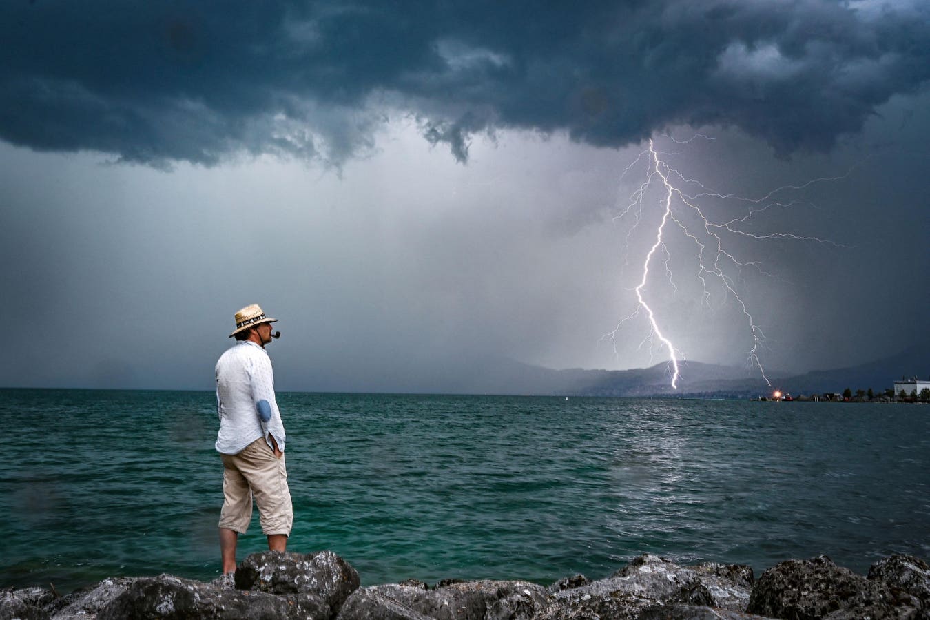
Some media reports have indicated that no rainfall occurred at the site of the strike. It is important to remind readers that lightning can happen far away from actual rainfall core. Such “bolts from the blue” are more common than you may think, so when the “thunder roars, get indoors,” even if it is not raining. The National Severe Storms Laboratory website defines it as, “A cloud-to-ground flash which typically comes out of the side of the thunderstorm cloud, travels a relatively large distance in clear air away from the storm cloud, and then angles down and strikes the ground.” I have seen many cases of lightning strikes several miles away from the actual thunderstorm. Often times, lightning strikes “from out of the blue” come from the anvil region of the storm, which can be several miles downwind of the main rain core. Chris Jackson of South Carolina Weather captured the radar image below of the likely strike though some experts question whether it was a true example of a “bolt from the blue.”
MORE FOR YOU
The storm that struck the area was very isolated and produced very little rainfall. According the National Weather Service discussion Tuesday morning, “Skies will start the day sunny, but then diurnal cumulus is expected to develop this afternoon.” Most guidance showed limited to no convection. However, NWS went on to say, “It should be noted that a couple of models show convection firing along the coastal trough, so cannot rule out at least the possibility of storms near the Pee Dee and eastern Midlands late this afternoon/early this evening.” Some experts believe other factors were at play, though it will take further analysis to conclusively determine causation.
Radar imagery shows the storm struck just downwind of Columbia. Though speculative at this time, University of South Alabama meteorology lecturer Jordan McLeod wondered if the storm was initiated by Columbia’s urban environment. Before rolling your eyes, numerous studies have shown that cities might provide lift or destabilization to produce thunderstorms because of the urban heat island and rougher landscape. McLeod has authored a series of papers in recent years on the urban rainfall effect. I have served as a collaborator on those studies and published scholarly work in this area for the past 20 years. These studies have suggested that regions over and just downwind of cities might be preferred for storms on days when very little meteorological forcing is present. On Tuesday, winds were blowing from east to west, which would place the Lake Murray region downwind of Columbia. One of our studies even showed that lightning anomalies might be preferentially oriented over and downwind of cities during the warm season.
Lake breeze circulations can also initiate thunderstorms during the afternoon because the surrounding land is warmer than water. If you go to the beach often, you may have noticed this with afternoon sea breeze storms, too. It will be interesting to see if the Lake Murray breeze by itself or in combination with an urban-related or other pre-existing boundary was responsible for this storm. From the common eye, storms may be perceived to “pop up” out of nowhere at this time of year, but closer meteorological inspection usually reveals a source of initiation.